Background
In December 2013, the south coast of England was hit by a storm surge from the North Sea. The storm saw hurricane-force winds and the highest tide in some places for almost 60 years. The tidal surge in the Newhaven area affected between 50 and 60 properties in the Railway Road area, as well as closing the railway line between Lewes and Seaford.
The scheme
The Environment Agency, in partnership with Lewes District Council, is developing a scheme to reduce flood risk from the sea. The scheme will reduce the risk of flooding to approximately 430 homes and 390 businesses in and around the East Sussex town of Newhaven.
The scheme will be designed to provide a 1-in-200-year standard of protection, taking into account the effects of climate change. This means that in any one year there will be a 0.5% chance that Newhaven will experience flooding from the sea. This greatly increases the flood protection to Newhaven.
In addition to homes and businesses, the scheme will also reduce the risk of flooding to local infrastructure such as the road network, railway line and a train station. It will support the wider regeneration of Newhaven, helping to bring new investment, jobs and homes to the area.
The scheme covers both banks of Newhaven, including the commercial areas near the port.
Construction of the scheme started in January 2017 and is scheduled to be complete by autumn 2019. The scheme has been divided into 5 areas:
- Area 1: A26 to Energy Recovery Facility
- Area 2: Energy Recovery Facility to Swing Bridge (East)
- Area 3: Riverside Park to Swing Bridge (West)
- Area 4: Swing Bridge (West) to West Quay
- Area 5: Swing Bridge (East) to Newhaven Beach
See the map of the scheme area
Funding
The scheme is estimated to cost around £18 million, with the majority of funding coming from the Environment Agency in the form of central government Flood and Coastal Risk Management Grant in Aid.
The Coast to Capital Local Enterprise Partnership and South East Local Enterprise Partnership are each contributing £1.5 million, as part of their wider commitment to regeneration in Newhaven. These contributions are essential to enable the project to proceed. Local Enterprise Partnerships (LEPs) were established across the UK by government. They are partnerships between local councils and businesses that decide what the priorities should be for investment in roads, buildings and facilities in the area.
Find out more about the LEPs by visiting the Coast to Capital website or the South East LEP website.
The Environment Agency always seeks funding contributions and co-operation from companies and organisations that will benefit most from the work. At Newhaven, the Environment Agency is working with Network Rail, landowners and others to help with building and securing additional funds for the scheme.
Construction update: October 2018
Work on the west bank is complete, reducing the flood risk to 244 homes, 88 commercial properties and vital infrastructure. The focus is now on the east bank.
Area 1: A26 to Energy Recovery Facility, construction nearing completion
The Environment Agency has constructed 2 clay-cored bunds to reduce the flood risk to properties on the east bank from the upstream flood plain. One bund starts near the A26 junction with the B2109 and extends roughly 500 metres west across the flood plain, where it will tie into a new railway flood gate, due to be built near the existing pedestrian crossing. The second bund will tie into the western side of the flood gate and extend to the Energy Recovery Facility.
The crest of the bunds is at the same level along the entire length. Beside the A26, the bund is 1.6 metres higher than existing ground levels, and near the railway, where the ground falls away towards the river, the bund is 2.7 metres above existing ground level.
Final seeding and landscaping works will be taking place along the bunds autumn 2018 to complete the earthworks construction in Area 1.
Work will be carried out in mid-October 2018 where the flood bund ties-in next to the A26. This will involve temporary 2-way traffic lights on the A26 for a period of 3 weeks.
Discussions are ongoing with Network Rail to finalise the design of the railway floodgate, which is due for construction in summer 2019.
During extreme flood events, demountable flood barriers will be put in place across the A26.
Area 2: Energy Recovery Facility to Swing Bridge, (East), construction complete
Area 2 extends approximately 850 metres along the East Quay from the Energy Recovery Facility to the Swing Bridge (East).
Following resolution of a series of complex issues facing the construction of the flood wall through waste and recycling sites, the flood wall was completed in September 2018.
Area 3: Riverside Park to Swing Bridge (West), construction complete
The Environment Agency has constructed a 150-metre-long bund north of Cantell’s boatyard and this will protect homes to the west. This work is now complete.
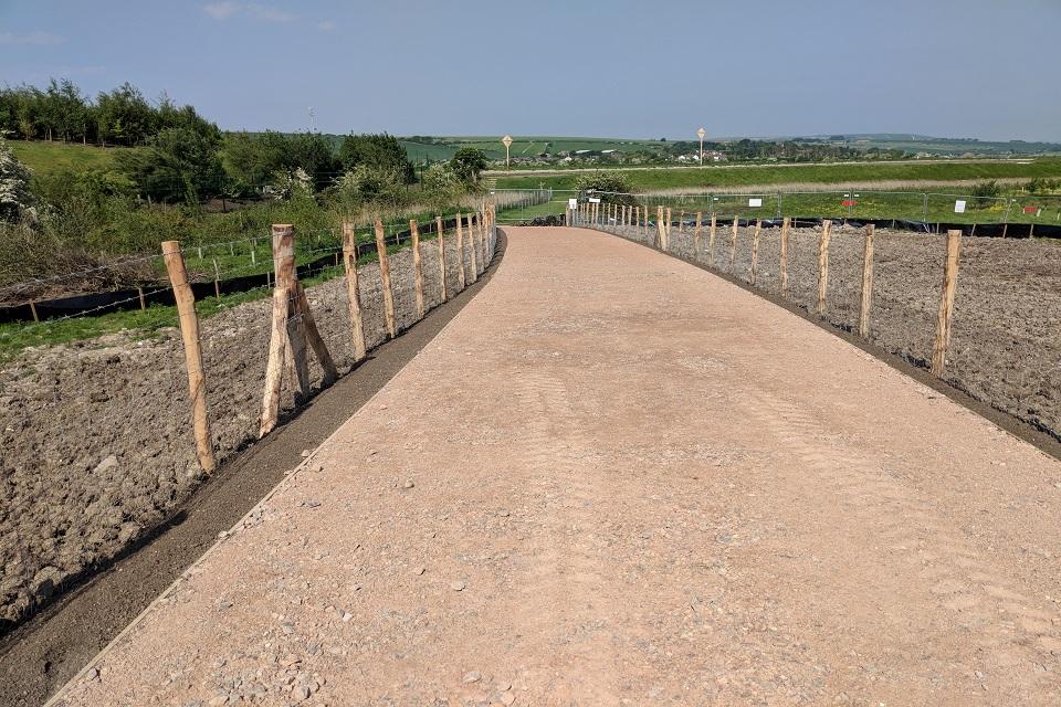
Denton Island work is now complete with the pedestrian footpath and cycle paths open.
Area 4: Swing Bridge (West) to West Quay, construction complete
Work within Area 4 started in January 2017 and was completed in June 2017.
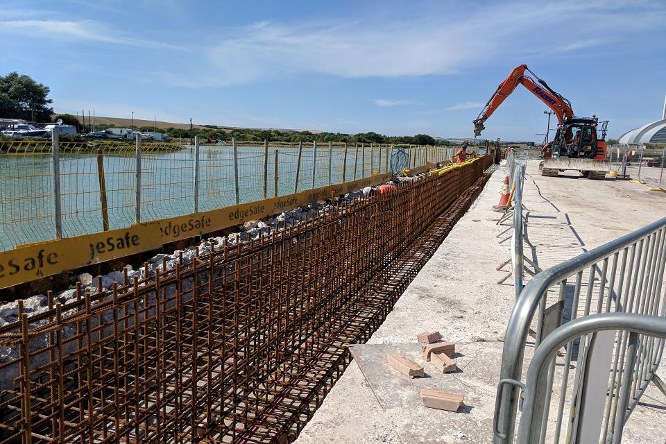
A 140-metre-long reinforced concrete wall has been constructed from the south west side of the swing bridge to a point adjacent to the Ark pub. The wall crosses the entrance to 3 fishermen’s jetties and demountable defences known as ‘stop logs’ have been installed to complete the flood defence here.
A 20 metre section of flood bund has been constructed in West Quay, raised by around 250 millimetres. This bund is complete, and the flood fence is operational.
In Huggett’s Green the low-level grass bund at the rear of Huggett’s Green has been realigned and raised to meet flood protection standards. The total length of the bund is approximately 150 metres which ties into the footpath near the promenade to the south. Walls have been built within the grass bund to offer seating on Huggett’s Green and more seating and hand rails are provided around the existing circular paved area. This also supports the new flood gate over the promenade, which will remain open when not in use during a flood event.
Following the completion of the work at Huggett’s Green in summer 2017, the area and bund were seeded, trees were planted and the new grass became established. However, there was a low spot and the long winter had an impact on the grass. Once the weather improved, contractors re-landscaped the low spot and sowed some more grass seed. Despite this, the green is still not looking its best and the Environment Agency is working with Newhaven Town Council, Lewes District Council and their contractors Jackson Hyder to return it to its original condition before handing it back to Lewes District Council.
Area 5: Swing Bridge (East) to Newhaven Beach, currently under construction
Area 5 extends from the Swing Bridge (east) along East Quay towards Newhaven Beach, a distance of approximately 1.3 kilometres. Planning permission is in place and detailed design is substantially complete, with some elements of the complex flood defence in the port area remaining to be finalised. Work in the port is due to be complete by the end of December 2018.
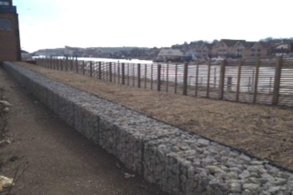
One part of this flood defence has been completed, namely the section between the Swing Bridge and the Customs Shed. This comprises gabions, an earth embankment and a concrete wall and was finished in September 2018.
Reducing the impact of construction
The Environment Agency will try to mitigate the impact of the work by:
- making sure work is only carried out between 8am and 6pm Monday to Friday, and 8am to 1pm on Saturdays. Noisy work will be carried out between 8.30am and 6pm with the remaining time used for quieter activities
- arranging large deliveries outside peak traffic times.
- using water to dampen down machinery and roads to reduce the amount of dust
- giving contact details on signs around all work sites
- fencing off all working areas
- removing all fencing and hoarding as soon as reasonably practicable after the work has finished
- keeping working areas tidy and removing waste materials from site on a regular basis
- informing residents of how long the work is going to take
- making sure site lighting does not intrude into adjacent areas
Protecting the environment
The Environment Agency has carried out an Environmental Impact Assessment (EIA) and the Environmental Statement was submitted as part of the planning application. This considered a number of topics including landscape, cultural heritage, ecology, noise, water environment and people.
Great crested newts were found in Area 1 and a mitigation strategy followed. Japanese knotweed was found in Area 4 and a mitigation strategy was put in place during the work.
The presence of other protected and/or notable species include reptiles, breeding and wintering birds, and other aquatic species and habitat which supports otters and water voles were assessed. Mitigation for all environmental constraints has been identified in the Construction Environmental Management Plan.
Community engagement
The Environment Agency will continue to speak to residents and businesses that may be directly affected by the proposals, including attending local events, drop-in sessions for residents and one-to-one meetings with businesses on the east bank.
Timescales
Construction of the scheme started in January 2017. The whole scheme is due to be completed by autumn 2019.