The coastline includes a range of diverse habitats, from rocky clifflines to extensive saltmarsh and sand dune habitats. They are home to diverse examples of plants, animals, and birds. However, all have adapted to suit a salty (saline) environment.
Sand dune habitats
Sand dunes occur on wide, sandy beaches whose dominant wind direction is onshore, such as those at Camber Sands or Climping. Sand from the main beach dries out and is blown to the back of the beach where it builds up. They are different to inland desert dunes as they are influenced by waves and vegetation, which affect their size and shape. With the exception of blowouts and parabolic dunes, most coastal dunes are stationary, held in place by vegetation.
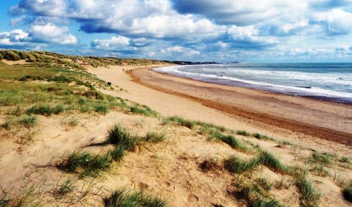
Dunes are initially formed by the wind moving particles of sand by saltation (bouncing), traction (rolling), or suspension (airborne or flying). The first stage of dune formation leads to the formation of embryo dunes. These are initially formed when sand is trapped, often by seaweed to the high water mark. Alternatively, seed bearing litter may allow colonising vegetation to grow, such as marram or lyme grasses. As more sand is trapped, the dunes build up, eventually forming foredunes. Because they are relatively young, and contain low levels of humus (dead organic matter), they are sometimes known as yellow dunes. As plants die and new ones grow, humus builds up and the dunes become increasingly grey. The dunes also increase in height to 10-30m, when their supply of sand is reduced due to their increasing distance from the beach. However, they may continue to be shaped by wind blowing over the dunes creating eddies that shape dune hollows.
Some coasts are characterised by unstable dunes with little vegetation to hold them in place. These dunes may occur along a whole coastline, or be areas within a mature dune system with less vegetation. This may result in blowouts, where wind blows sand that has become mobile because of human activity (paths, introducing livestock that eat the vegetation) or naturally during dry periods when vegetation dies back. This allows the sand to move, creating hollows. If the blowout grows until its length is three times greater than its width, it is then known as a parabolic dune. These can become stable again if they become vegetated. However, if they don’t, and form within previously vegetated dune systems, then they may merge into one large transgressive dune.
Saltmarsh and mudflat habitats
Saltmarshes are vegetated mudflats, which generally occur in the intertidal zone in temperate climates. Usually found on gently-sloping shorelines, their form is determined by tides, sediments, freshwater inputs, and shoreline structure. They support a range of halophytic (salt-tolerant) vegetation, and are divided into low-, middle-, and upper-saltmarsh depending on how often they are inundated by the tide. They are one of the most productive ecosystems, yet are nationally scarce. Saltmarsh is found in a number of locations along the South East Coastal Group coastline, including Shellness on the Isle of Grain and Pagham Harbour in Sussex.
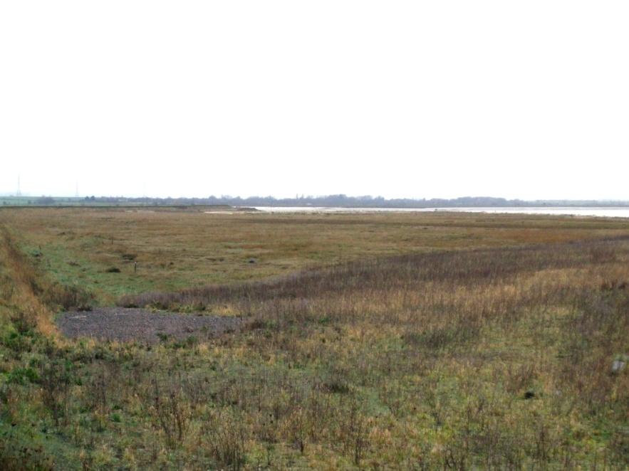
Mudflats forms in sheltered locations where wave action is low and currents are weak, such as the Swale in the Thames Estuary. As these processes approach the shore, they slow and silts and clay held in suspension are deposited. Because this material can be easily moved, mudflats are often quite mobile. Over time, mudflats build up through larger sediment particles becoming trapped, or where plants such as algae and Salicornia (small, succulent herb-like plants) trap mud particles. This raises the surface of the mudflat so it is exposed for longer periods at low tide, allowing vegetation to colonise the mudflat. Saltmarsh vegetation in the south-east mainly consists of Puccinellia maritima (common saltmarsh grass), Juncus geradi (blackgrass or saltmarsh rush), Salicornia spp., Spartina anglica (common cord grass) and Spartina tonwsendii. These occur at different saltmarsh levels, depending on how tolerant they are of being inundated at high tide.
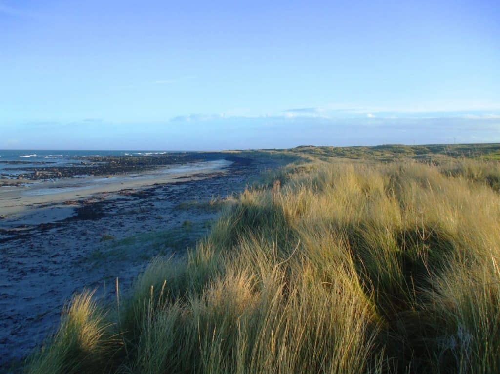
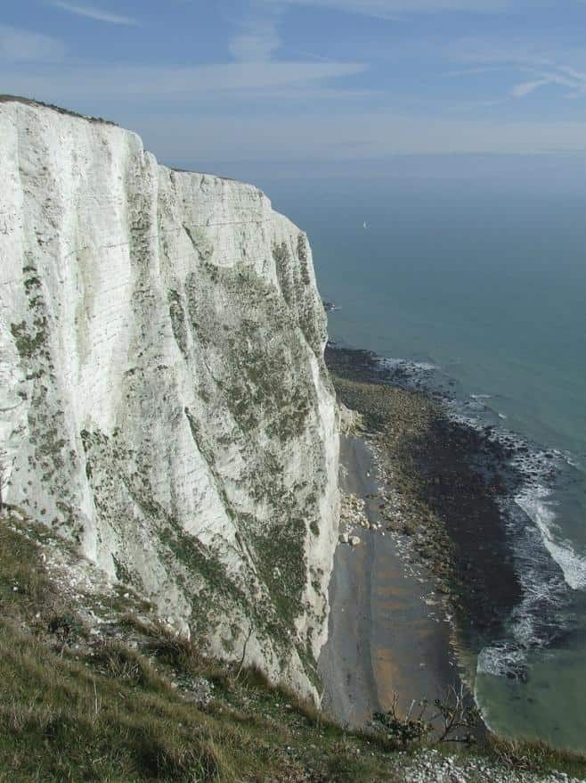
Rocky shore and cliff habitats
Unlike the previous two habitats, rocky coasts are the result of erosion, not accretion processes. These are heavily influenced by geology, which in the south-east can range from chalk (Seven Sisters, Dover, Thanet) to clay and glacial till (Warden Point, Fairlight). Cliffs tend to be actively receding, although this isn’t always the case. As cliffs erode, they form a variety of landforms such as caves, blowholes, gorges, arches, and stacks.
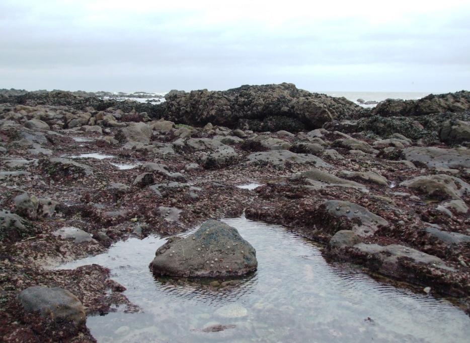
As cliffs recede, they generate debris that feeds the beach at the base of the cliff, or beaches downdrift of the cliff falls. Many cliffs are bordered by rocky shore platforms, that are formed either by waves (wave-cut platforms) or coincide with the more resistant bedrock. These can either be flat or sloping, and are often inundated at high tide. This creates pools of water, trapping sediments and allowing algae and other vegetation to colonise the shoreline. The pools are also home to crustaceans, fish, and other animals such as barnacles, edible crabs, limpets, chitens, scorpion fish, dog whelks, squat lobster, keelworms, piddocks, and limpets.
Conservation and management of coastal habitats
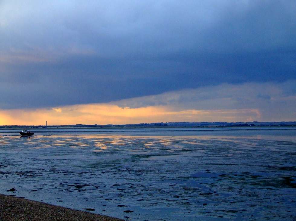
The Kent and Sussex coastlines support an abundance of wildlife habitats and physical features, some of which are nationally rare. Over time coastal habitats and features change, so effective conservation involves providing sufficient space to allow them to move and evolve in response to the action of the sea. Much of the coastline is also responding to rising sea levels and climate change. On some low-lying coasts this causes substantial losses of intertidal habitats because of coastal squeeze. This is the process by which saltmarshes, mudflats, and beaches are eroded as they become trapped between rising sea-levels and fixed seawalls. These losses also affect the management and cost of flood defences, many of which rely on these habitats as natural defences to reduce wave energy. This means that the coast needs to be managed in a way that sustains both the nature conservation interest and the economic and social needs of human communities.
There are a number of ways in which this is achieved. Firstly, the four shoreline management plans covering the South East Coastal Group coastline address key shoreline management issues, whilst taking into account designated habitats. The designated habitats are classified by Natural England, and include Sites of Special Scientific Interest (SSSIs), Special Protection Areas (SPAs), Special Areas of Conservation (SACs), Ramsar sites, National Nature Reserves (NNRs), and Marine Conservation Zones (MCZs). In addition the Habitats Regulations, which implement the European Habitats Directive in the UK, provide effective protection to coastal sites within the Natura 2000 series.
The conservation of terrestrial and freshwater features that are presently protected by sea defences is a related issue. In the face of rising sea levels, defending such sites may be unsustainable, expensive and make the problems of coastal squeeze worse for intertidal habitats in front of seawalls. In these cases the best conservation option may be achieved by managed realignment and re-creating freshwater habitats in sustainable locations elsewhere.
Further reading
- Bird, E. (2000), Coastal Geomorphology – An Introduction. John Wiley & Sons Limited, Chichester.
- Mitsch, W.J., Gosselink, J.G. (2000), Wetlands (3rd Edition). John Wiley & Sons Limited, Chichester.
- Thomas, S. G., Goudie, A. (2000), The Dictionary of Physical Geography (3rd Edition). Blackwell Publishing, Oxford.
- Waugh, D. (2000), Geography – An Integrated Approach (3rd Edition). Nelson, Walton-on-Thames.
- Woodroffe, C.D. (2002), Coasts – Form, Process and Evolution. Cambridge University Press, Cambridge.
- www.environment-agency.gov.uk
- www.naturalengland.org.uk